


Sun-seekers are gearing up for the hottest weekend of summer as Britain catches the burn of a 40C sizzling Continental heatwave.
Temperatures will rocket through the next 72 hours with southeastern counties facing highs of 30C.
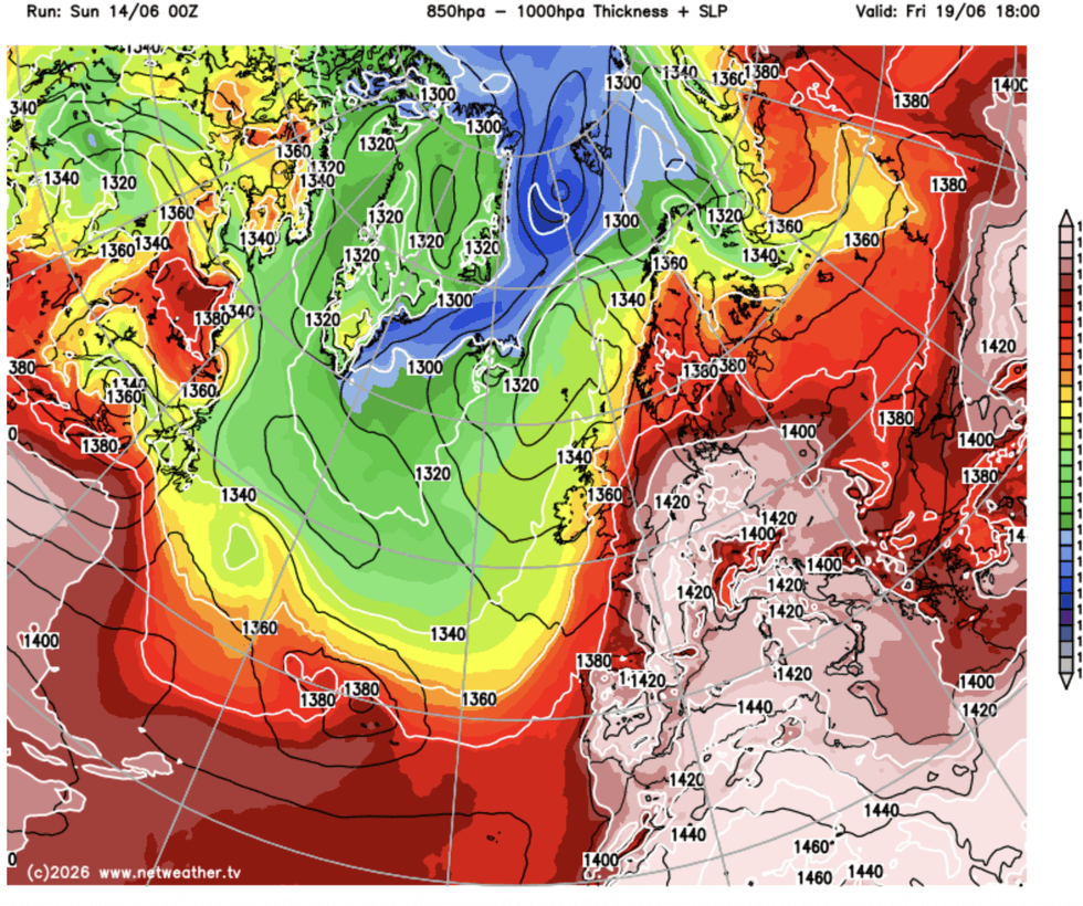
The first possible heatwave of the season will be boosted by a plume of hot air surging from Europe.
Met Office meteorologist Alex Burkill said: “There is some pretty hot air across western Europe, and parts of Spain, France and Italy could get above 40C, and some of that hot air could just about clip into parts of the southeast later this week.
“Temperatures are likely to get to 28C, with 30C not out of the question, and across parts of Wales it looks like it will be the warmest day of the week.
“Further north and west, it is going to be cloudier and a bit fresher with some rain with low pressure lingering to the northwest of us.”
Today will feel slightly cooler than yesterday, he said, before the continental flames flicker across the English Channel.
Southern counties will roast in the highest temperatures ahead of the weekend while elsewhere will be fresher with the risk of rain, he added.
He said: “With more cloud and rain, towards the southeast temperatures could be a bit down compared to Tuesday.
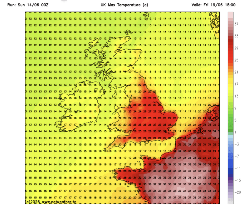
The Met Office says 30C is not out of the question by Friday
|NETWEATHER
“On Thursday, to the south of a front over us, we could start to get some of that hot air from the near Continent, and towards the northwest it is staying fresher.
“It is quite wet across northern Ireland, western and northern parts of Wales, parts of northern England and much of Scotland, but across the rest of England things should brighten up in the afternoon.”
Heat and humidity will build from today before cranking up tomorrow and into the weekend.
Southern and southeastern areas could nudge past the 30C mark as high pressure builds across Britain.
LATEST DEVELOPMENTS:
Britain will catch the edge of a european heatwave
|NETWEATHER
Jim Dale, meteorologist for British Weather Services and co-author of ‘Surviving Extreme Weather’, said: “High pressure starts to build as we go into the weekend, and we could be looking at temperatures above 30C in parts.
“The heat will be largely across southern and southeastern counties, and it will be fresher further north.
“With heat, we will see rising humidity.”
As atmospheric conditions destabilise, swathes of Britain will be at risk of heavy rain and thunder, he warned.
He said: “There could be some big thunderstorms through the end of the week, and with these there will be the risk of heavy rain.
“This will be the result of atmospheric instability due to rising temperatures and humidity.”
Unsettled outbursts threaten festival goers heading to outdoor events over the next couple of weeks.
A Met Office spokesperson said: “Overall, the festival outlook reflects a typical variable UK summer pattern, combining warm sunshine with periods of rain and the risk of thunderstorms, particularly later in the week as humidity increases.
“Forecast confidence remains moderate, especially regarding the timing and intensity of showers. Festivalgoers are advised to stay up to date with the latest forecasts and be prepared for a range of conditions, from warm sunny spells to sudden downpours.”