


A storm front splicing Britain in two will plunge parts of the country into chilly winds while elsewhere bakes in summer’s first heatwave.
Temperatures of 30C-plus will roast southern, central and eastern counties in the run up to the weekend.
But a colossal cold front swept into Britain by a low-pressure storm cell will plunge the mercury in western and northwestern regions.
Met Office meteorologist Alex Burkill said: “There is a front lingering across us, and to the south of this, we could get a bit more hot air coming in from the near Continent, but to the northwest, it is staying fresher.
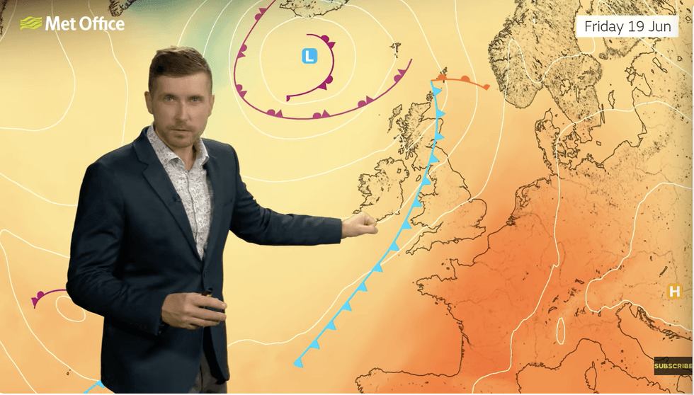
“On Friday, we still have a front across us, and this forms boundary between something fresher to the northwest and the southeast where we have hotter air coming in from the near Continent.
“Eastern parts are going to be hotter than average while western parts could be a little bit cooler than average, and that is because of the front, forming a boundary between the two air masses.”
Thermometers will start to rise today, with highs tomorrow in the southeast expected to touch the low 30s.
Where warm and cool air masses meet, volatile atmospheric conditions will trigger thunderstorms.
Thermometers will start to rise today with highs tomorrow in the southeast expected to touch the low 30Cs
|GB NEWS
Cool winds to the north and the west will keep a lid on the mercury while the south threatens to breach heatwave criteria.
Mr Burkill said: “We are going to stick with northern and western parts being a bit cloudy with more rain, and a cooler feel.
“But towards the southeast, temperatures are set to rise into the high 20Cs and perhaps the low 30Cs by Friday, which means that we could technically have a heatwave here.
“There will be some thunderstorms because of that hot humid air, and there is a fair bit of rain to come this week.”
LATEST DEVELOPMENTS
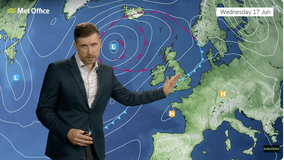
Cool winds to the north and west week keep a lid on the mercury while the south threatens to breach heatwave criteria
|MET OFFICE
With soaring heat will come humidity, making for uncomfortable "tropical" nights in southern regions.
By the end of the week, central regions, including the Midlands, will also simmer in 30C highs.
Jim Dale, meteorologist for British Weather Services and co-author of "Surviving Extreme Weather", said: “We are now looking at serious heat in parts of the country by the end of the week and into the weekend.
“Temperatures are going to build, and it is going to feel very uncomfortable with humidity, especially across southern and eastern parts.
“Further north, it will feel cooler.”
Battling airmasses in the path of a cold front threaten torrential downpours across central regions, he warned.
He said: “There is a cold front coming across the country, and it has venom.
“This will trigger heavy downpours and thunder, and some of the thunderstorms will be impressive.”